ANNAPURNA CIRCUIT
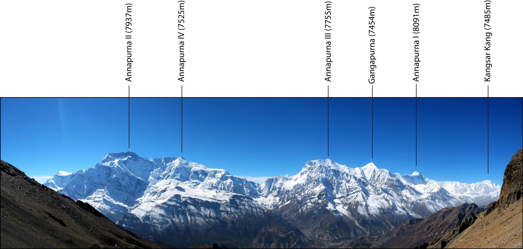
We decided on this hiking trip while cycling through the Terai in the Nepalese lowlands. The intention was to get some distraction from the cycling, but also to further marvel at the scenery of the high-alpine summits in the central Himalayas. The Annapurna range exposes the entire range of altitude and includes a whole series of summits with the highest peak reaching up to 8091 meters a.s.l. It is a quite young formation that was heavily deformed by recent glacier advances. The valleys are steeply notched and often fissured. Thus, the circuit is among the most stunning trails in Nepal and probably beyond.
The circuit is mapped in the following googleEarth gadget. If you have it installed, you can fly over the trail and gaze in 3D at the scenery of the Annapurna range. If not, you can download the .kmz file and import into your own geo mapping application.
THE TRAIL
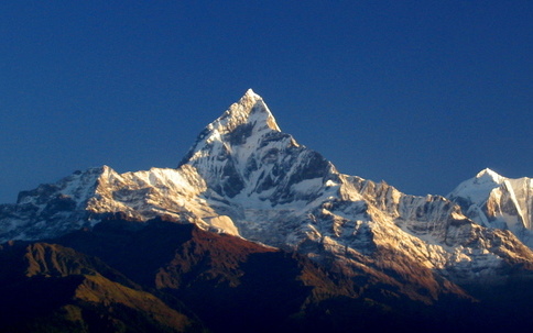
The hiking trail starts in Besisahar and takes a lap around the whole Annapurna range passing Chame, Manang, Jomsom, Ghorepani and finally ending in Pokhara. It climbs from 750m up to 5350m and back down. We chose the route to Tilicho Lake, a meltwater lake at 4900m which is fed by several glaciers from the Tilicho Himal and the Kangsar Kang peaks. This particular route is off the main trail and only a few hikers dare this glacial passage, due to unpredictable weather conditions and consumptive climbs. On the way down we extended the lap taking some extra stages in Eastern direction to get the front views of the range including the impressive panorama of the Machhapuchhre summit. We took 20 days of walking to complete the lap and unwinded 251 km and close to 13.230 meters difference in altitude.

The hiking trail is only accessible by foot or with donkeys. No road allows vehicles to enter the remote mountainous area. This was one of the reasons why we carried all our equipment by ourselves. Tent, sleeping bags, cooking gear and food for 20 days had to find space in our backpacks. A challenge in the beginning, but becoming literally lighter with distance. However, according to our experience with 20 days we reached the capacity of carrying supplies. In the end we were relieved every time we found a little orchard where we could feast some apples and similar. Rationing our supplies for more than two weeks all thoughts center around food and food and more food. Yet is was a great experience to not always have the abundance we are so used to.
Camping was organised with or without tent in the narrow river valleys avoiding over-priced guesthouses along the main path. You can find the camp locations on the googleEarth map at the top of the page. For the same reason we regularly left the trail for some alternative routes leading us up on the slopes of the nearby peaks. One of these alternative routes started in Lower Pisang and continued on the steep faces of the Northern range providing fantastic panoramas of all the peaks in the Annapurna massif.
The most sparkling experience of the trail was certainly the Tilicho Lake passage. Here we entered into a snow and ice environment and the vicinity to the glaciers and the ice-capped peaks was worth the effort of the extra-steep ascent. We camped at 5150m near the Lake and crossed the Mesakantu pass after climbing for a few hours in dense fog and slippery ground that was covered with snow the night before. Fortunately, there was a number of sherpas unvoluntarily guiding us along the invisible trail.


Having passed the Tilicho stage the rest of the trail was a promenade compared to the days before. Not least because of the vanishing weight on our shoulders. The trail descents following a wide meandering river valley that dispels the orchards and gardens into the narrow side valleys. Finally, we reached Tatopani and decided on another little detour that would lead in Eastern direction providing views on the Southern panorama of the Annapurna range. The surroundings now became much more philantropic and countless little villages nestle along the green and densely vegetated slopes. After the harsh hikes on the Northern face of the range this part is now compensating with friendly people, warm temperatures but still stunning views on the more and more distant series of Annapurna summits.


