Resume Iceland 2011
| The following text summarizes the experiences and impressions from a three weeks hiking tour in Iceland in July 2011. It also includes some info and thoughts on Icelandic issues we coincidently came across or learned about. The link to the right yields a series of images. |  |
Means of travelling
Among western countries with fully developed tourist infrastructure, Iceland is probably among the most welcoming to individual travellers. It is becoming an increasingly popular destination for hikers and cyclists to experience the fascinating nature on their own, offside all-inc cruise holidays or organized bus trips. In a way, two different means of exploring Iceland coexist without much interference or disturbance. Although drive-in camp sites, farm accommodation and hotels are available all-around the island, backcountry camping is widely allowed or at least accepted.
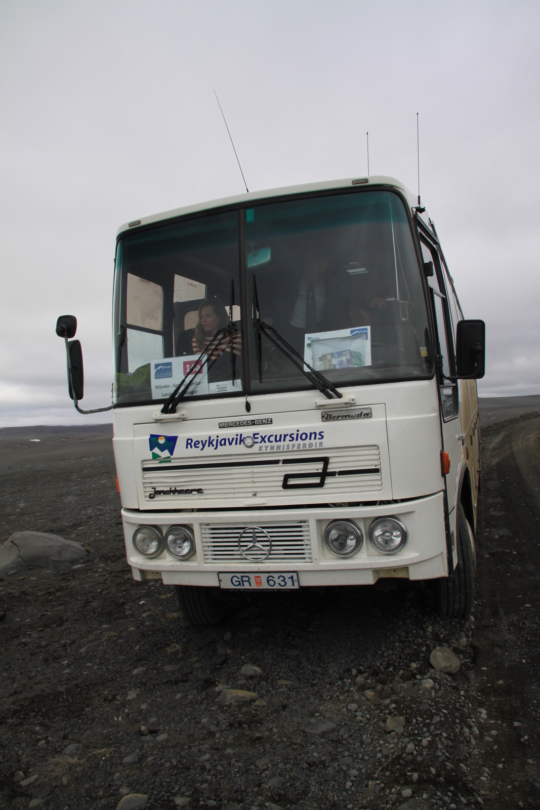
When travelling to Iceland, we chose the shoestring option using only our own feet and hitch-hikes to get around. Despite the number of half a million annual visitors relative to a population of little more than 300.000 people, the island is pretty secluded as soon as walking off the ringroad. The ultimative transportation is the car and leaving the road is almost equivalent to leaving the people. Hiking is possible literally everywhere, up the volcanos, down the river valleys, along the coastline or through the steaming lava fields. If distances become too long, hitch-hiking is likely the quickest method to move on. Waiting times vary between 10 and 20 minutes, ironically rather shorter on the more remote roads. We experienced city dwellers from Reykjavik, farmers from the North, tourists, foreign workers, truck drivers, freelancers and unemployed people who gave us rides. Everybody is willing to help. Either because of sympathy or compassion, we never figured it out.
In the gadget you can follow our route. The green lines mark our hikes, the red lines indicate the passages we hitch-hiked and the white lines point to the stretches we chose the bus as our mean of transport. The according mapping file is of course available as .kmz file.
Snæfellsnes
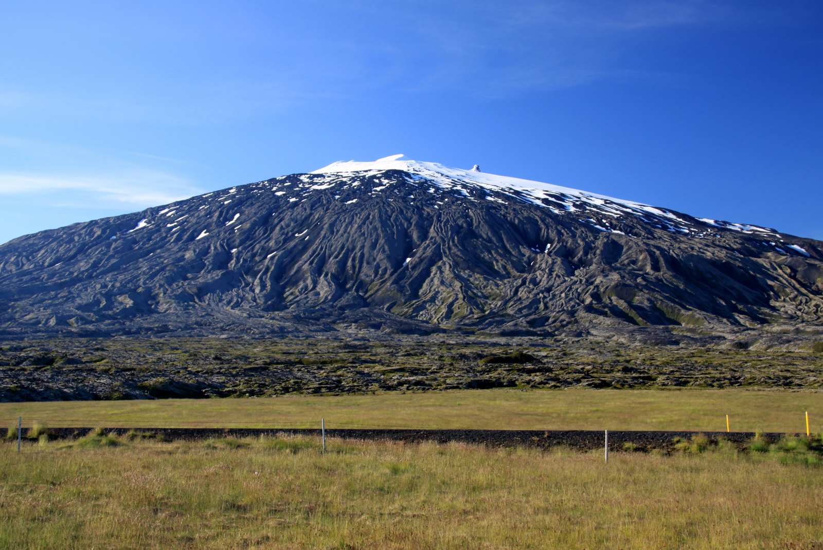
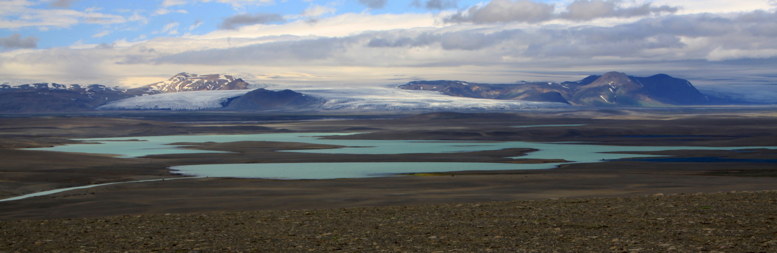
We started from Reykjavik north-eastwards to the Snæfellsnes peninsula. It is the geological oldest part of Iceland and has a stunning stand-alone volcane at the Eastern tip. The Snæfellsjökull volcano is 1450m above ground impresses with a permanent snow capped peak. We started the hike at the southern coastline ascending to the glacier margin circulating three quarters of the mountain, permanently rewarded with fantastic views on the ocean. In three days not a single person came across our way, maybe because there was not exactly a path to follow. We walked and rested and camped wherever and whenever wanted.
The lowland around the volcane is covered with lava fields. The hardened lava is broken up and diverts all water into the ground. This means that hikers have to carry all water themselves. Reaching the snow fields at around 1000m, water of course is again abundant. This hike is among the most beautiful, due to the stunning views, the untouched environment and the almost unique loneliness.
Geology
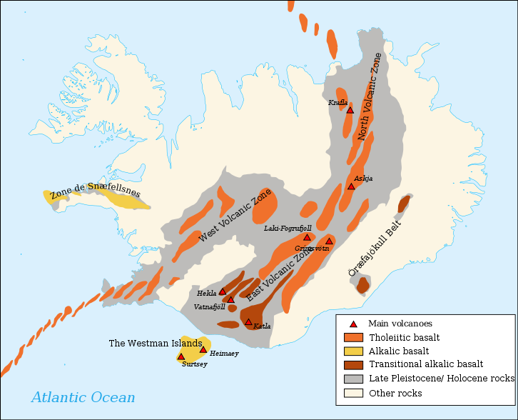
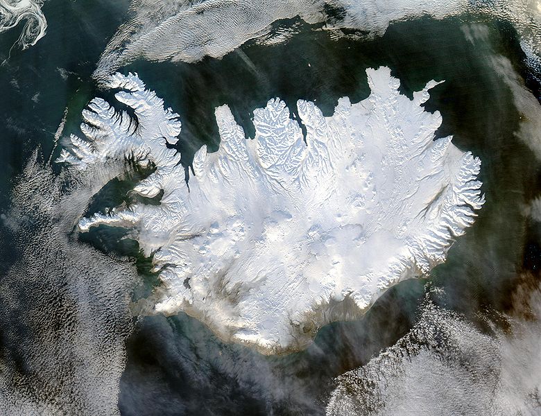
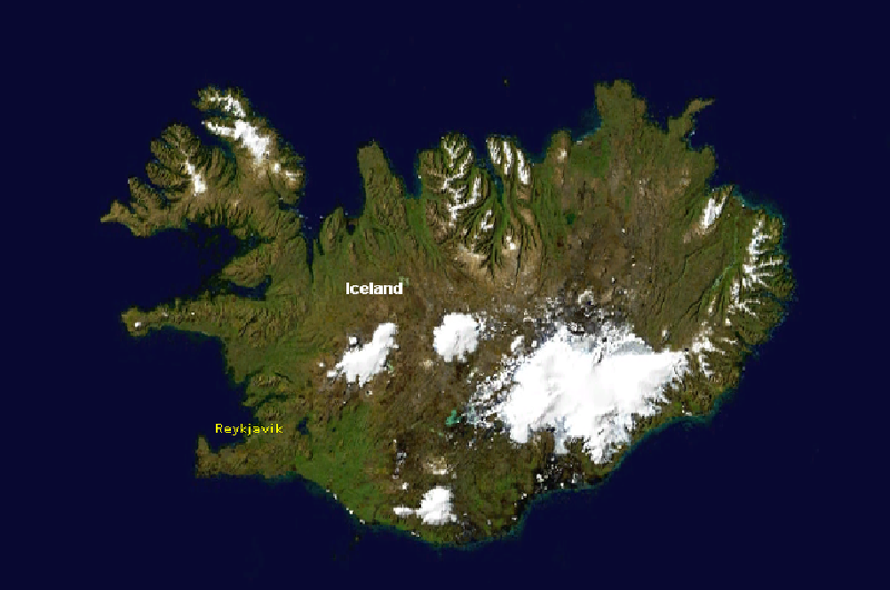
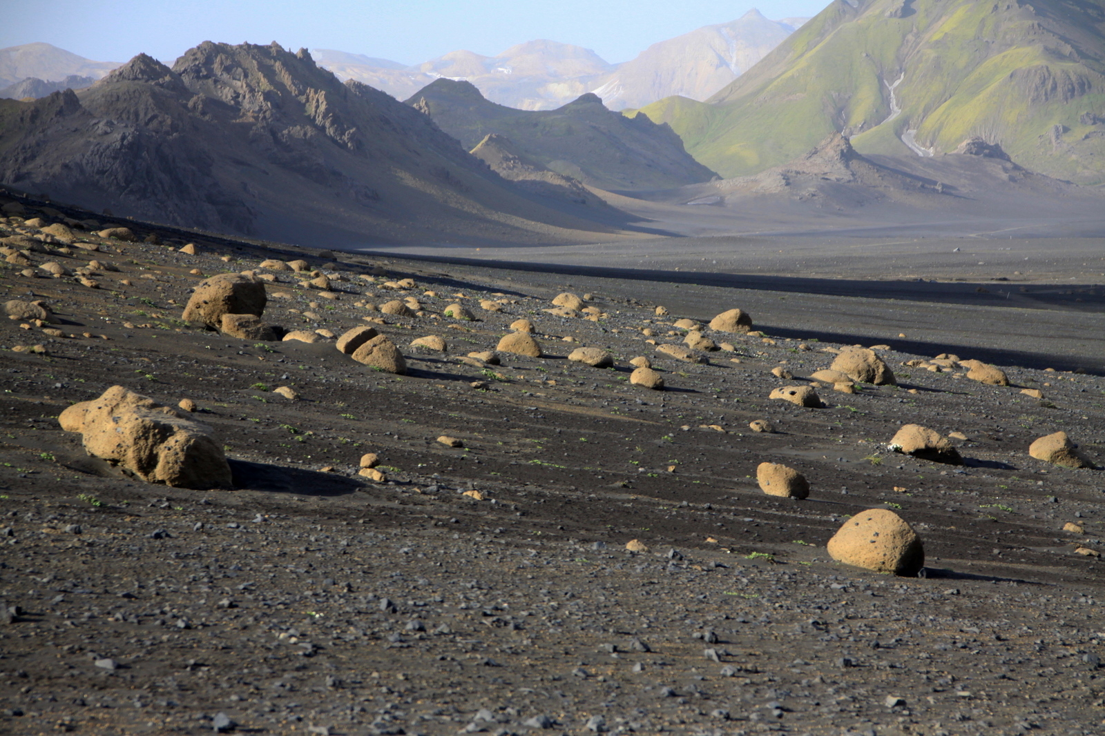
Iceland is located on the geologic rift between the Eurasian and North-American plate. The so-called Mid-Atlantic ridge is still diverting and rising magma leads to a constant growing of the island. Along the ridge there is a number of volcanos building large lava fields that consist of young basalt rocks (see map). Towards the Eastern and Western edges of the island the geology consists of mainly displaced ignous rocks that were found to be the oldest basalt formations cooled around 3.3 mio years ago. This geological dynamic also has an impact on the variability of the vegetation. Along the ridge and in the centre of the island there is only dark-grey rock desert, whereas towards the coastlines evolve lush meadows and minor forests, as time was sufficient to build up a fertile soil cover.
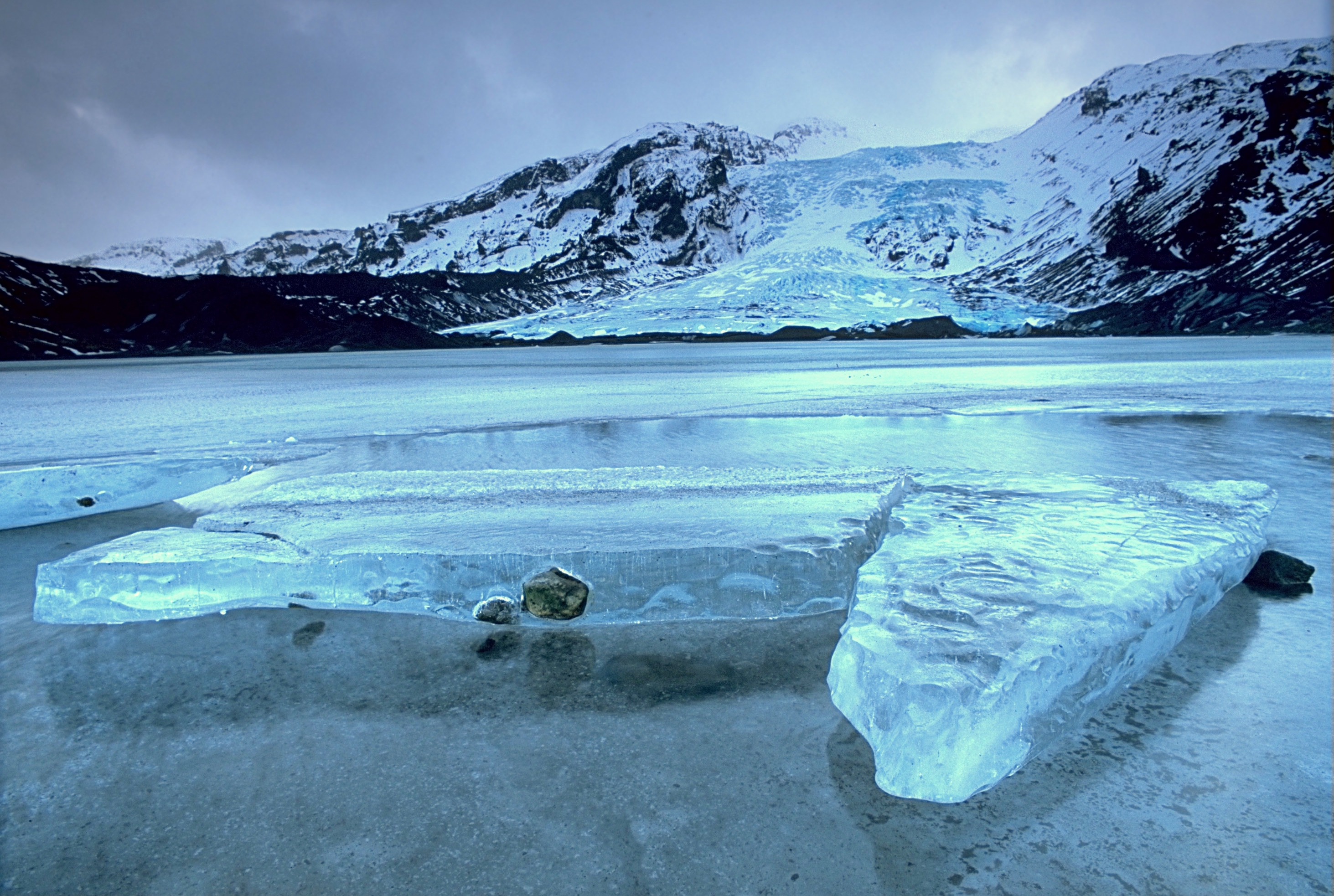
Glaciers and volcanos
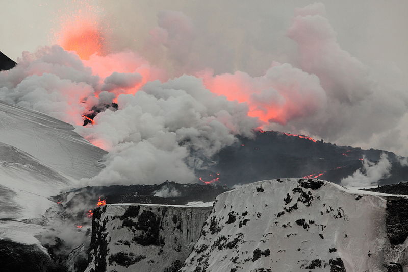
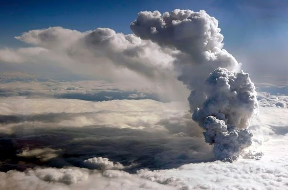
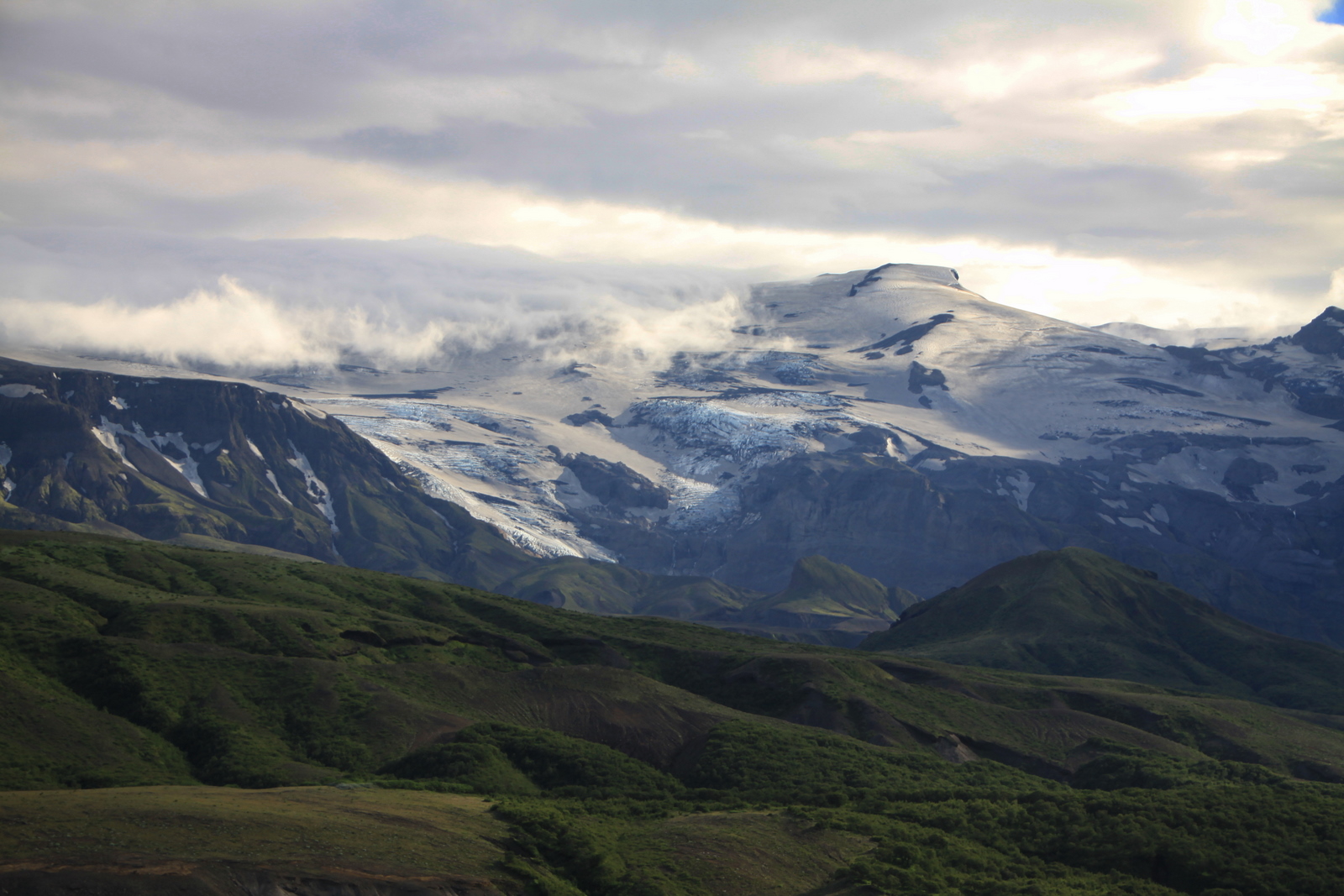
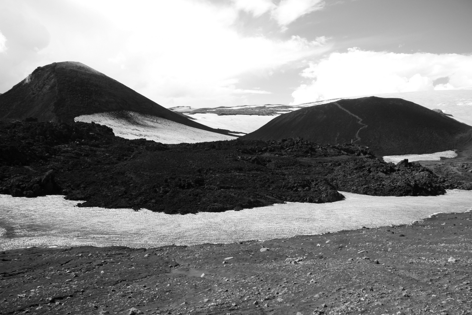
The combination of polar lattitudes, hot magma and apine volcanos creates bizarr interplays between ice and fire. All mountains in Iceland are volcanos and many of them have a thick snow and ice cap. The thickness of the ice varies as the temperatures do not always stay below zero, but some of the main glaciers still have a thickness of 50 to 100 meters. In July 2011 a volcanic eruption underneath an ice cap led to a massive Jökulhaup, releasing subglacial meltwater and flooding the Southern coastline. The highest and still active volcano is Hekla with almost 1500m at the top. Everybody remembers the eruption of the Eyafjallajökull in April 2010, which spit ashes 11 km into the athmosphere severely inhibiting the European air traffic. The lava of this eruption is in 2011 still warm and steaming on a side branch of the Myrdálsjökull. However, the main load of the volcano was black ashes that in places cover the land up to two meter.
Jökulsar Hike
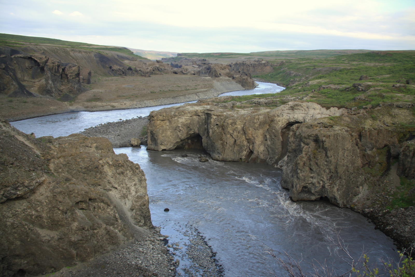
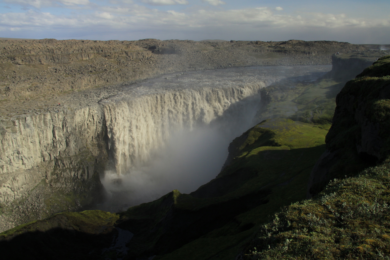
The hardest part of the Jökulsar hike is to get to the entry point. It is located in the truely remote Northeast, where only a medium-maintained sideroad follows the meandering coast line. Once there, the hike is a self-runner. Simply follow the river. And simple to follow it is indeed, as the Jökulsar cut an 80 meter deep and almost vertical canyon in the basalt geology. The river transports meltwater from the Vatnajökull draining the Northern catchment of the glaciated volcano. The hike follows from the river mouth upstream ending at a cascade of waterfalls. The most of impressive of which is probably Dettifoss. The hike can be done easily in three days (more like 2½ days) but the path is clearly marked and tourists are seen in some sections were there are access points from the road. Nonetheless, the hike is worth seeing the canyon, the basalt columns and the waterfalls. Particularly when willing to avoid to tourist magnet Gullfoss.
Nordic Culture
The Icelandic culture is on the first view not exactly obvious. Seeing only sheep and farms and barren soils it is hard to imagine what the Icelandic people do behind the walls of their remote houses. In fact, Iceland has tremendous cultural life in literature, story telling and music. The writers Halldór Laxness with his white Jaguar or the pop-writer Hallgrimur Helgason are in Iceland known like the prime minister. Story-telling is a national sport. Every second Icelander writes at least one novel once in life. Besides literature, music is no less popular. Björk, Múm or Sigur Rós are only the best known examples of a huge music scene. The annual festival Airwaves takes place in Reykjavik and is popular far beyond Iceland. Music is performed with friends at home, in small cafes or in the new Concert Hall in Reykjavik that was designed by the danish-icelandic designer Olafur Eliasson. Every month 10 new bands evolve in Reykjavik. Quite a number for 120.000 inhabitants.
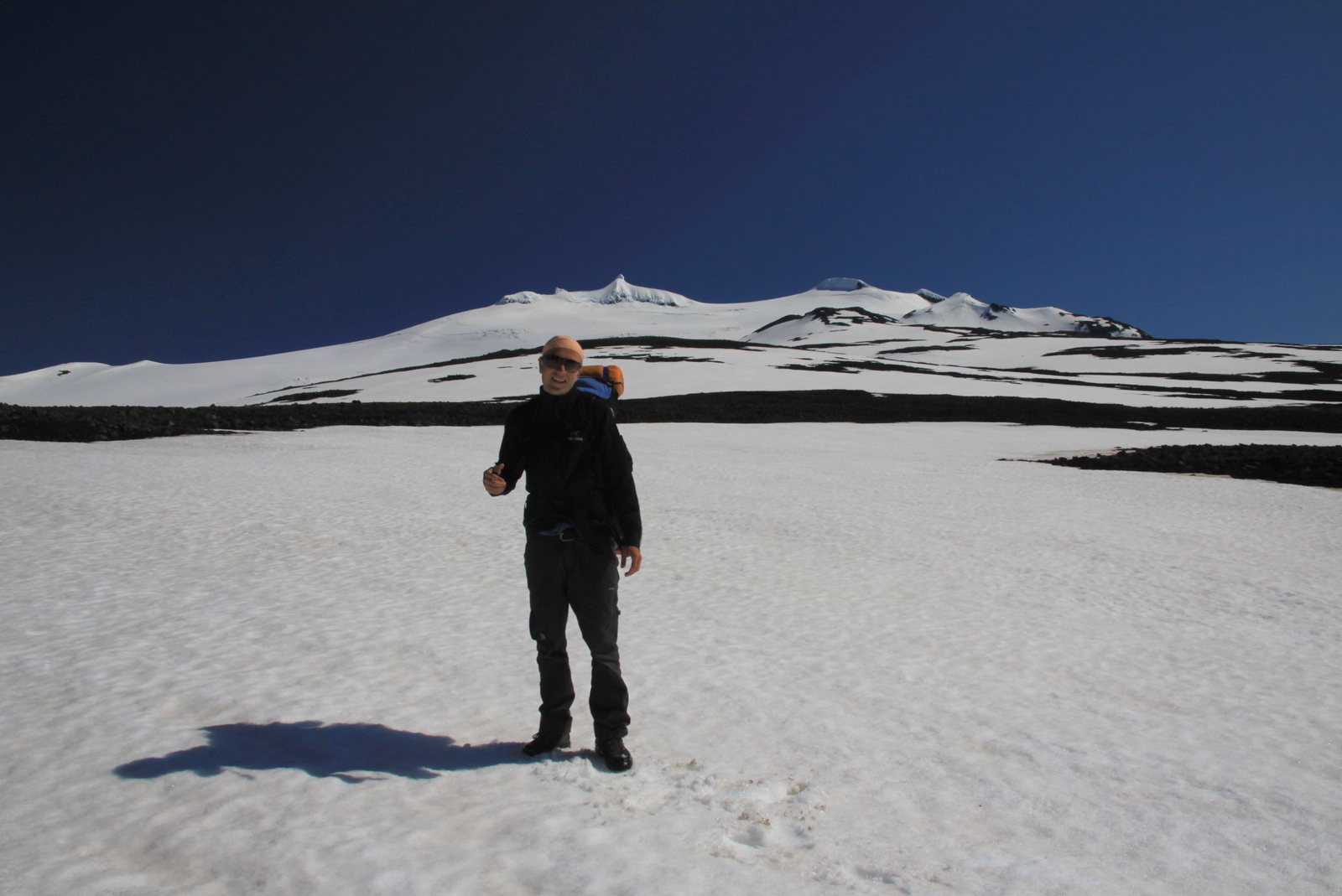
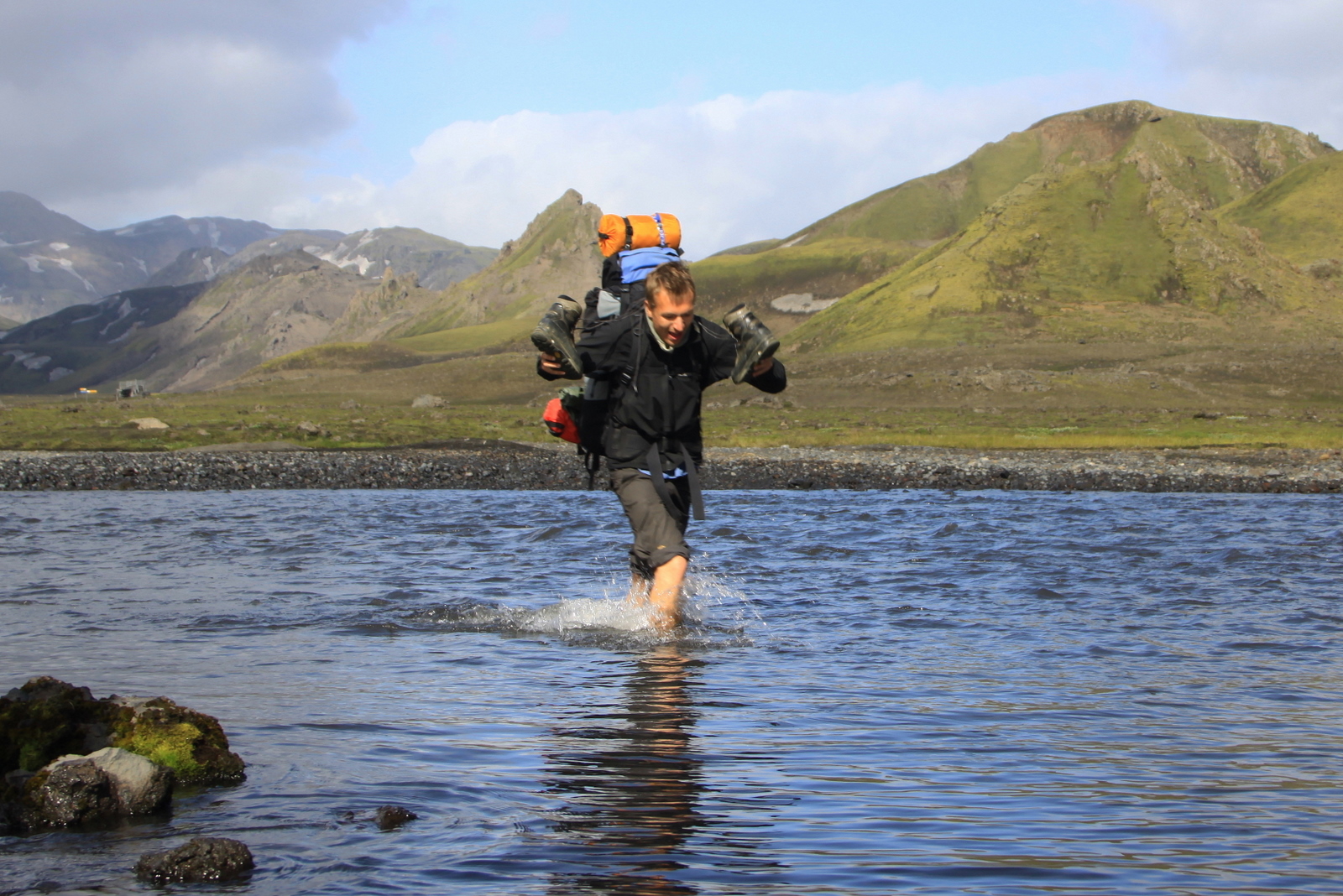
Laugavegur
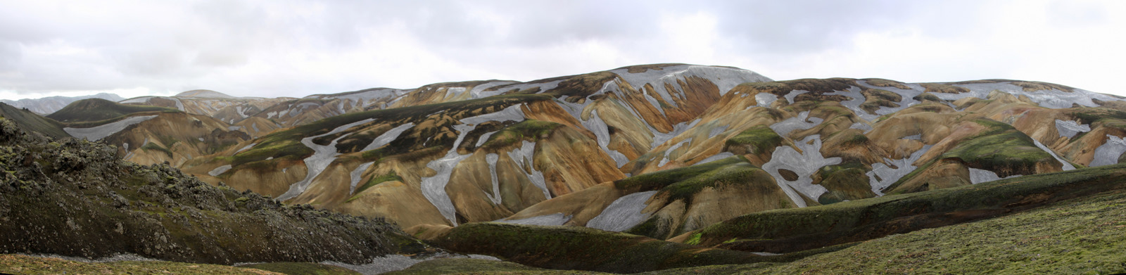
This long-distance path is likely among the most stunning ones a hiker can experience. Starting with an ascent of 400m the hike crosses a moonscape formed only by volcanos and glaciers. It passes several sulphur springs, snow and lava fields and quite a number of damn cold meltwater streams. It is not too optimistic to call it one of the most diversified hikes we experienced. The trail in total is 55 km long and one or two overnights are recommended. There are a number of camps along the way, which do not have to be pre-booked. Just arrive and camp. The trail ends in Thorsmørk, a green river valley collecting the meltwater from Vatnajökull and Myrdálsjökull.
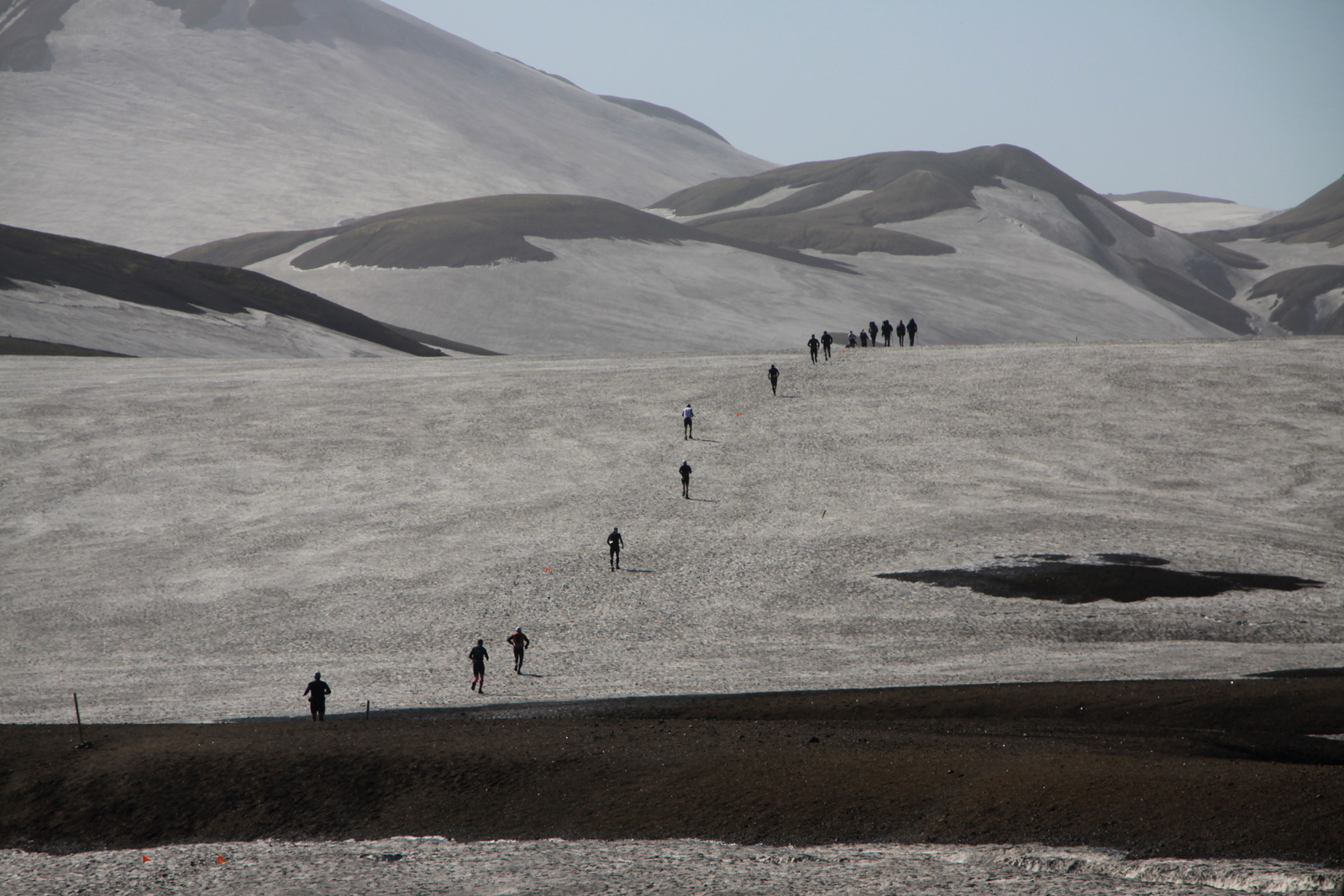 In July the trail is turned into an ultramarathon with a few hundred participants among who the fastest is running the 55 km over snow and lava fields in ¨5 hours.
 An additional experience is to follow the trail all the way to Skogar on the Southern coast. This trail crosses the volcano ridge between Eyjafjalla- and Myrdálsjökull and provides fantastic views on the recent generated volcano cones and lava fields. The peak of this one day hike is the Fimmvörduhals, a hut in between the two massive glaciers. This stage requires another 22 km walking and around 1000 m ascending.
Geothermal springs
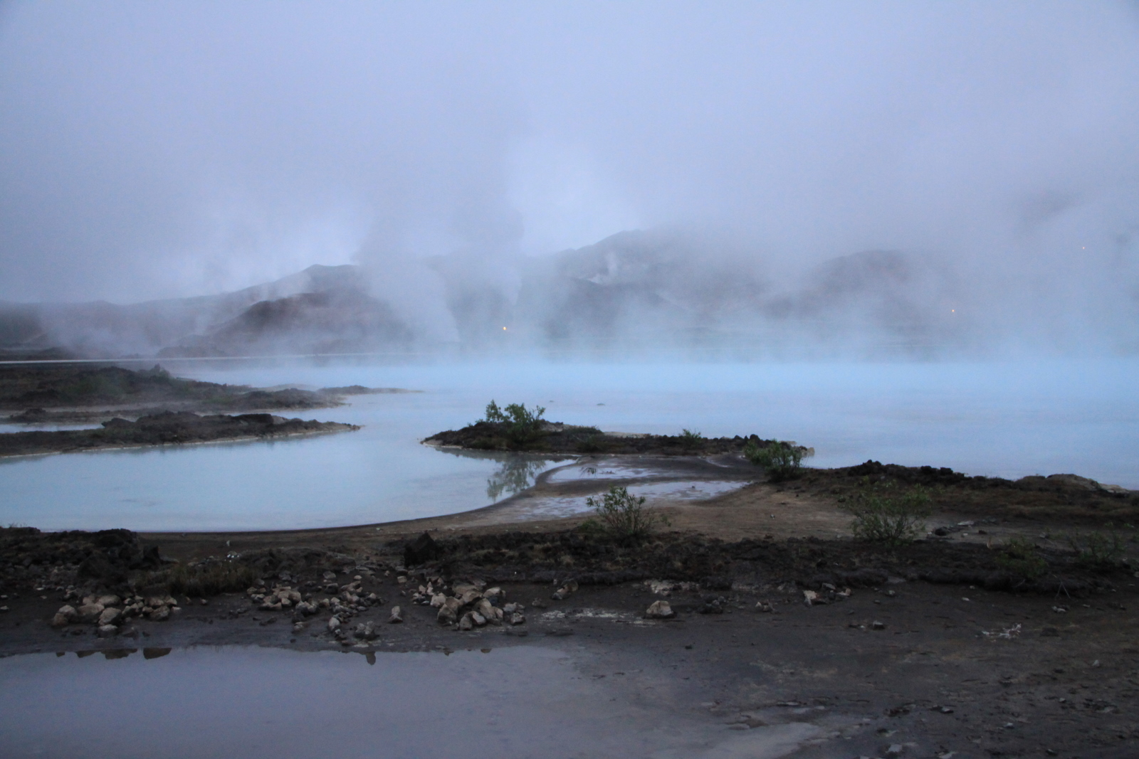
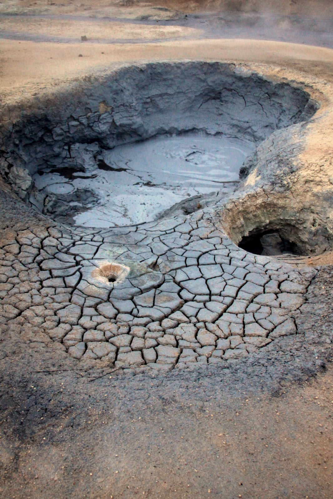
Iceland’s most unique features are hot springs that are found all around the island. Particularly in the lava fields in the North and Southwest water or other subsurface liquids are bubbling up at the surface. A lot of the ponds have constantly between 30 and 40 degrees invite the Icelanders for year-round baths even when the winter cold has a lock on people and environment.
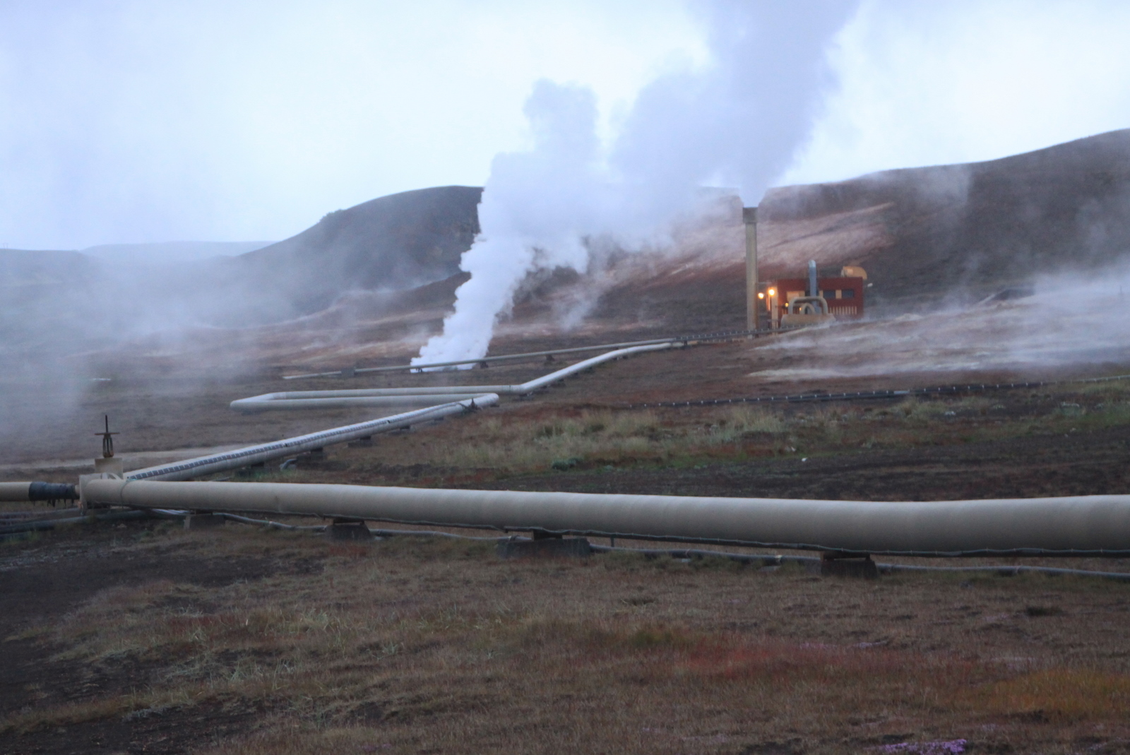
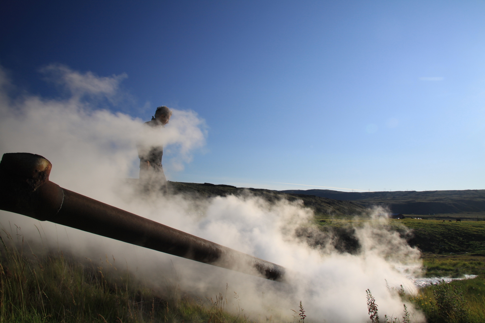
The geothermal water of course is also used for industrial purposes. 87% of all housing is heated with district heating or long-distance heating. Geothermal power stations use the heat of the water to produce electricity. A quarter of Iceland’s electricty is produced from geothermal heat and together with hydro-power the renewable energy sources account for 99.9% of Iceland’s need. This has lead to the attraction of energy-intensive industries, e.g. Aluminum production. Companies like ALCOA import the resource and process it in Iceland, due to low electricity prices. The aluminum industry poses huge environmental risks and the leachate is highly toxic devastating the sensitive environments. These activities led to the foundation of an environmental movement called Saving Iceland, where Icelandic musicians, authors and activists create environmental awareness and also try to fight the Aluminum industry in Iceland.
http://www.savingiceland.org/tag/century-aluminum/Lastly, the crisis
The financial desaster hit Iceland in 2008. Following similar greed symptoms as seen in other countries the banking sector collapsed over night, being incapable of recapitalizing itself. The consequence was a major devaluation of the Icelandic currency resulting in a deep economic recession between 2008 and 2010. The three largest banks Kaupthing, Glitnir and Landsbanki were nationalized or turned into receivership. Up till today, the Icelandic economy has not entirely recovered, however, many people in Iceland turned the crisis into a chance for a new start. Focusing again on their strenghts, which has never has been their willingness to do big business, but rather their creativity and their capability to promote their cultural heritage. It is relieving to see, that many Icelandic people, despite the fact that they lost immense amounts of money, did not get lost in frustration, but learned from the past designing a new future under different premises.